Around the World (And Sun Valley) With Jose Mier
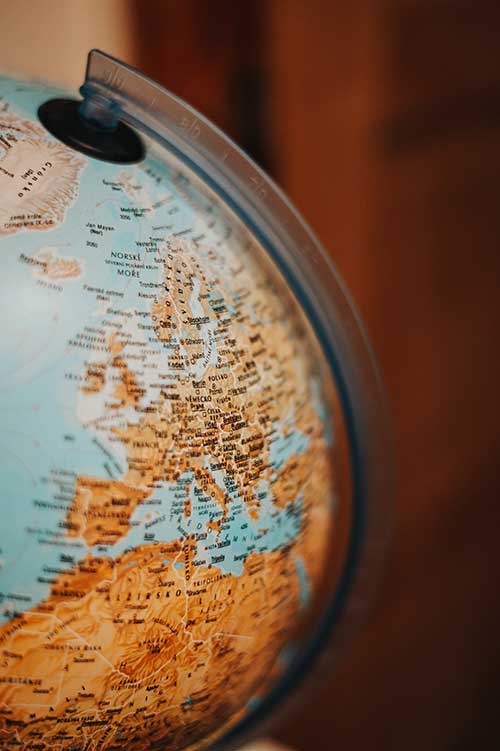
Jose Mier has found a website that easily displays the geographic coordinates of your town (latlong.net). But how often are latitude and longitude used around the world every day?
Latitude and longitude, the geographical coordinates that define a point’s position on Earth’s surface, are fundamental tools in our daily lives. While these coordinates have been crucial for centuries in navigation, today, they find applications that go far beyond charting uncharted territories. In this article, we explore how latitude and longitude are used in diverse ways across the world each day, from guiding travelers to facilitating global communication and everything in between.
- Navigation and GPS Systems
One of the most obvious and essential uses of latitude and longitude is navigation. Global Positioning System (GPS) technology relies on these coordinates to pinpoint locations accurately. From the GPS unit in your car to the maps on your smartphone, latitude and longitude enable real-time navigation, helping drivers, cyclists, and pedestrians reach their destinations efficiently and safely.
- Air Travel and Flight Paths
For pilots and air traffic controllers, latitude and longitude are indispensable. These coordinates determine flight paths, aiding aircraft in navigating the vast skies and ensuring safe takeoffs, landings, and in-flight routes. Whether it’s a commercial jetliner or a small private plane, accurate positioning is critical for aviation safety.
- Marine Navigation
Latitude and longitude have been the cornerstone of maritime navigation for centuries. Sailors and ship captains use these coordinates, along with nautical charts, to plot courses, avoid hazards, and reach their intended ports. Even in the age of advanced technology, traditional navigation skills using latitude and longitude remain crucial for seafarers.
- Emergency Response and Search and Rescue
During emergencies and natural disasters, precise location information can mean the difference between life and death. Emergency services, including police, firefighters, and paramedics, rely on latitude and longitude to locate accident sites, fires, and individuals in distress. Search and rescue teams also use these coordinates to locate missing persons, hikers, and those stranded in remote areas.
- Geocaching and Outdoor Activities
Geocaching, a global treasure-hunting game, would be impossible without latitude and longitude. Participants use GPS devices to follow coordinates and find hidden caches around the world. Beyond geocaching, outdoor enthusiasts use these coordinates for hiking, camping, and exploring remote locations, ensuring they stay on track and avoid getting lost.
- Astronomy and Celestial Navigation
Latitude and longitude are not limited to Earth; they also have applications beyond our planet. Astronomers use celestial coordinates to locate stars, planets, and celestial objects in the night sky. For centuries, sailors have employed celestial navigation, determining their position at sea by observing the positions of celestial bodies in relation to the Earth’s latitude and longitude.
- Time Zones and World Clocks
Latitude plays a significant role in the division of time zones across the world. As you move east or west from the Prime Meridian (0° longitude), time zones shift, affecting local time. Longitude lines determine the local time difference from the Greenwich Mean Time (GMT). Time zone boundaries are essential for coordinating global activities, scheduling flights, and conducting international business.
- Weather Forecasting and Meteorology
Meteorologists use latitude and longitude to monitor and predict weather patterns. Weather stations worldwide collect data at specific geographic coordinates, which allows meteorologists to create weather maps and forecasts. Latitude influences climate zones, affecting temperature and precipitation patterns, while longitude plays a role in predicting storm tracks and severe weather events.
- Land Surveying and Property Management
Land surveyors rely on latitude and longitude to determine property boundaries and accurately map land parcels. These coordinates are essential for property ownership records, land development, and urban planning. They help ensure that land use adheres to zoning regulations and property rights are respected.
- Environmental Monitoring and Conservation
Latitude and longitude are crucial in environmental monitoring and conservation efforts. Researchers use these coordinates to track wildlife migration patterns, study ecosystems, and identify areas of ecological significance. Geographic coordinates also assist in monitoring deforestation, tracking the spread of diseases, and managing natural resources sustainably.
- Global Communication and Coordination
In the interconnected world of global communication, latitude and longitude play a vital role in synchronizing activities across time zones. International telecommunications networks rely on these coordinates to route calls and data worldwide. They also facilitate coordination among businesses, governments, and organizations with operations spanning multiple countries.
- Location-Based Services (LBS) and Mobile Apps
The ubiquity of smartphones and mobile apps has made latitude and longitude even more integral to our daily lives. Location-based services (LBS), such as ride-sharing apps, restaurant finders, and weather apps, depend on these coordinates to provide users with personalized information and services tailored to their specific locations.
- GIS (Geographic Information Systems)
Geographic Information Systems (GIS) are powerful tools used in various fields, including urban planning, agriculture, and disaster management. GIS relies heavily on latitude and longitude to store, analyze, and visualize spatial data. These systems help professionals make informed decisions by integrating geographical information into their work.
- Tracking and Monitoring Cargo and Shipments
In the global supply chain, knowing the precise location of cargo and shipments is essential for logistics and transportation companies. Latitude and longitude coordinates enable real-time tracking, helping businesses manage inventory, optimize routes, and ensure timely delivery of goods to customers worldwide.
- Archaeology and Historical Research
Archaeologists and historians use latitude and longitude to locate and excavate historical sites. These coordinates aid in pinpointing the exact locations of ancient cities, archaeological remains, shipwrecks, and other historical artifacts. Researchers can then piece together the puzzle of our past using this geographical data.
Conclusion
Latitude and longitude are the geographical coordinates that underpin a multitude of applications worldwide, from navigation and emergency response to environmental monitoring and global communication. In our increasingly interconnected world, these coordinates continue to be essential tools that enable us to explore, understand, and interact with the planet we call home. Whether you’re navigating your way to a new destination, studying the stars, or tracking a shipment halfway across the world, latitude and longitude quietly but significantly influence our daily lives.